Log in
All resources
Create a design
40,684 Free Images of 1882 Maps
atlantis magni tomus secundus (biblioteca comunale di trento)
maps in the stadsarchief amsterdam
caspar philips
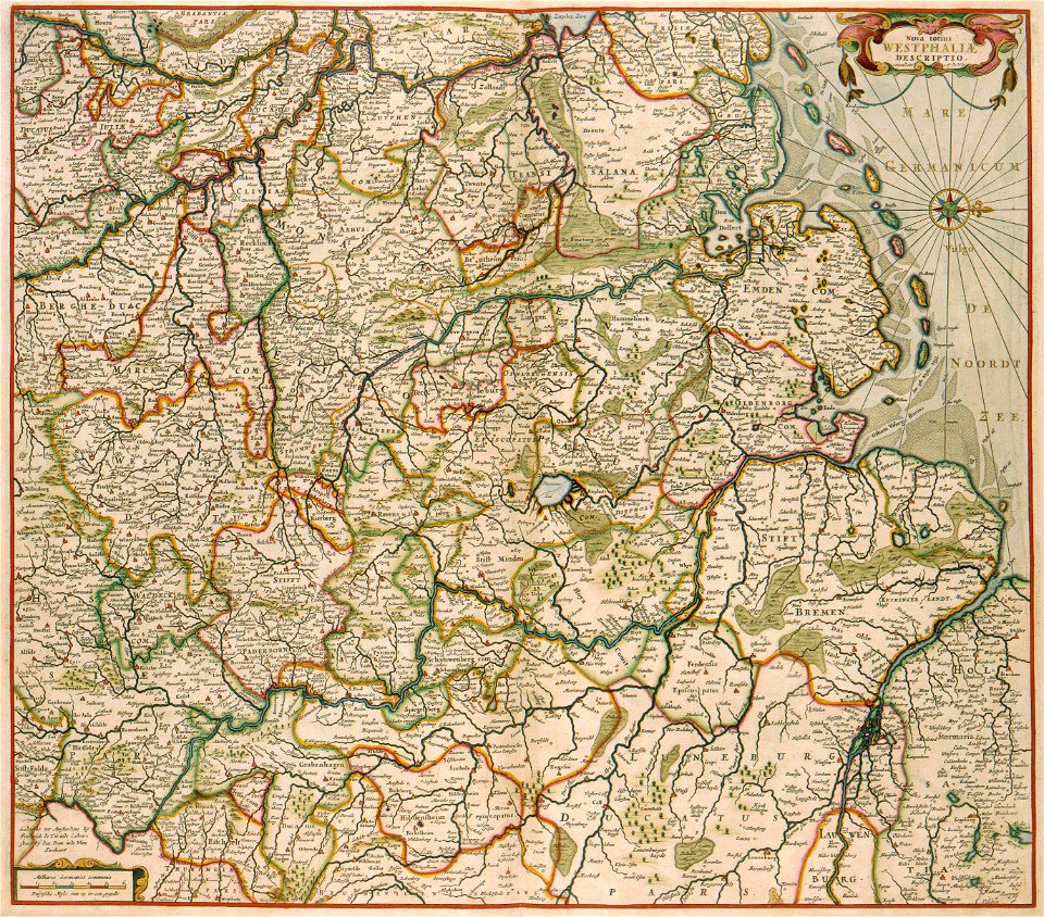
maps made in the 17th century
old maps of dutch brazil
johannes vingboons
old maps of amsterdam
description de l'universe
maps made in the 18th century
geographical illustrations by coronelli
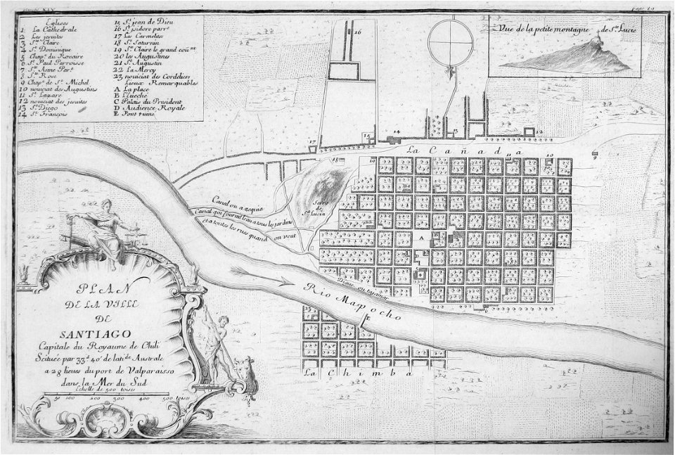
frézier's travel
chile
frézier's travel
bahia
maps by george h. walker and company
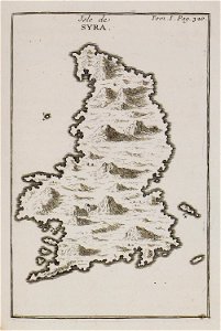
joseph pitton de tournefort
maps of syros
geographical illustrations by coronelli
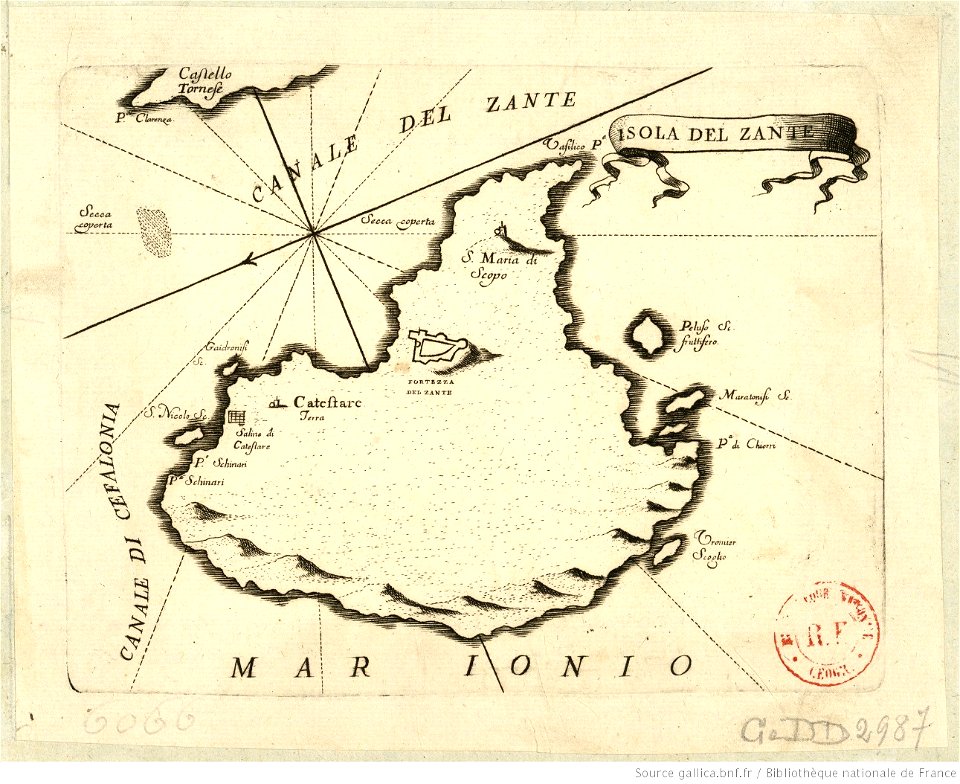
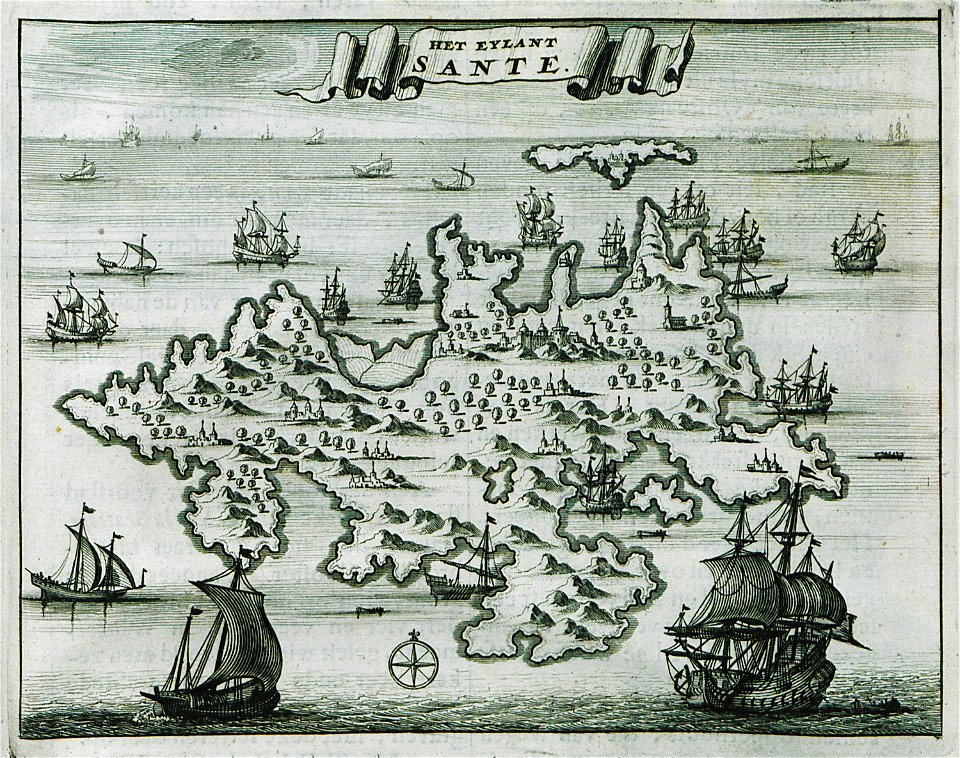
maps of zakynthos
geographical illustrations by coronelli
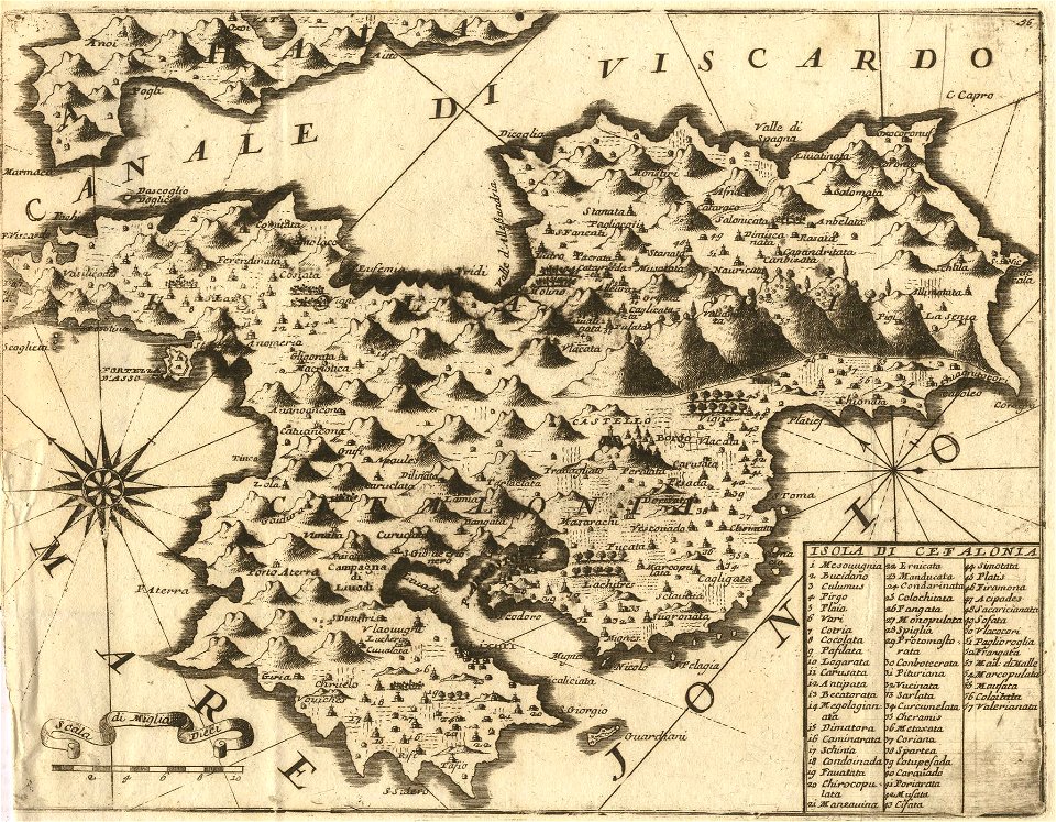
maps of kefalonia
geographical illustrations by coronelli
maps of icaria
old maps of greece
sant
historical images of homel
maps of homieĺ
old maps of scandinavia
johann baptist homann
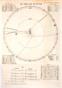
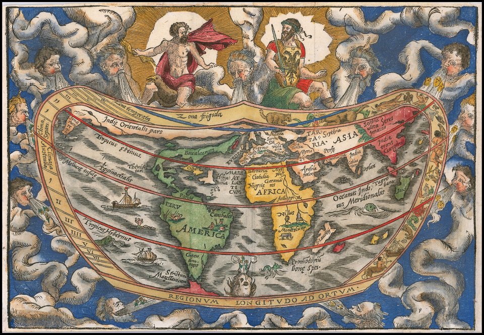
old celestial maps
comet
royal observatory
greenwich
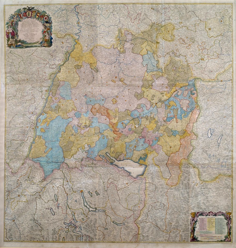
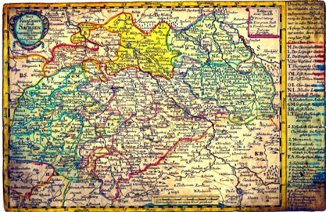
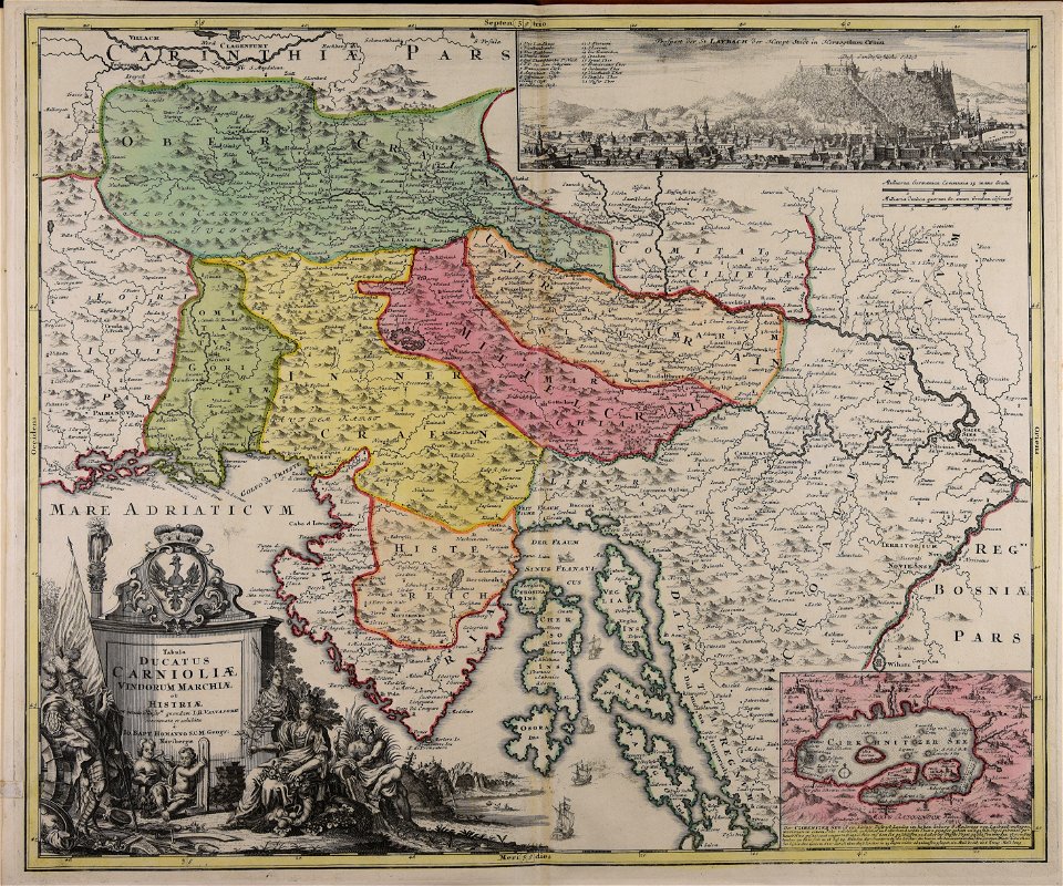
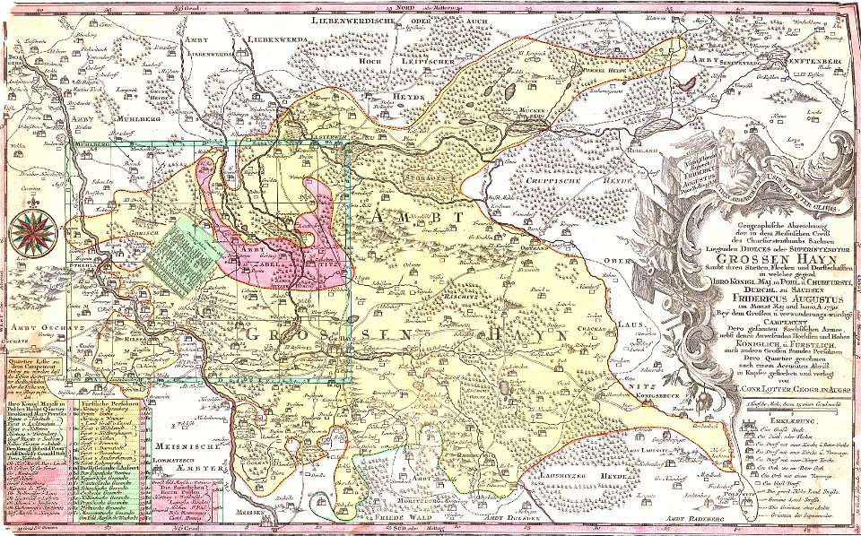
1750s maps of baden-württemberg
swabian circle
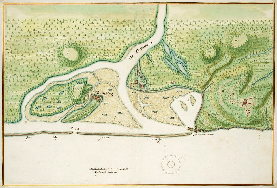
old maps of dutch brazil
johannes vingboons
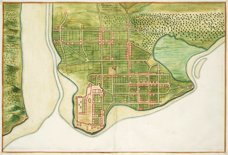
old maps of dutch brazil
johannes vingboons
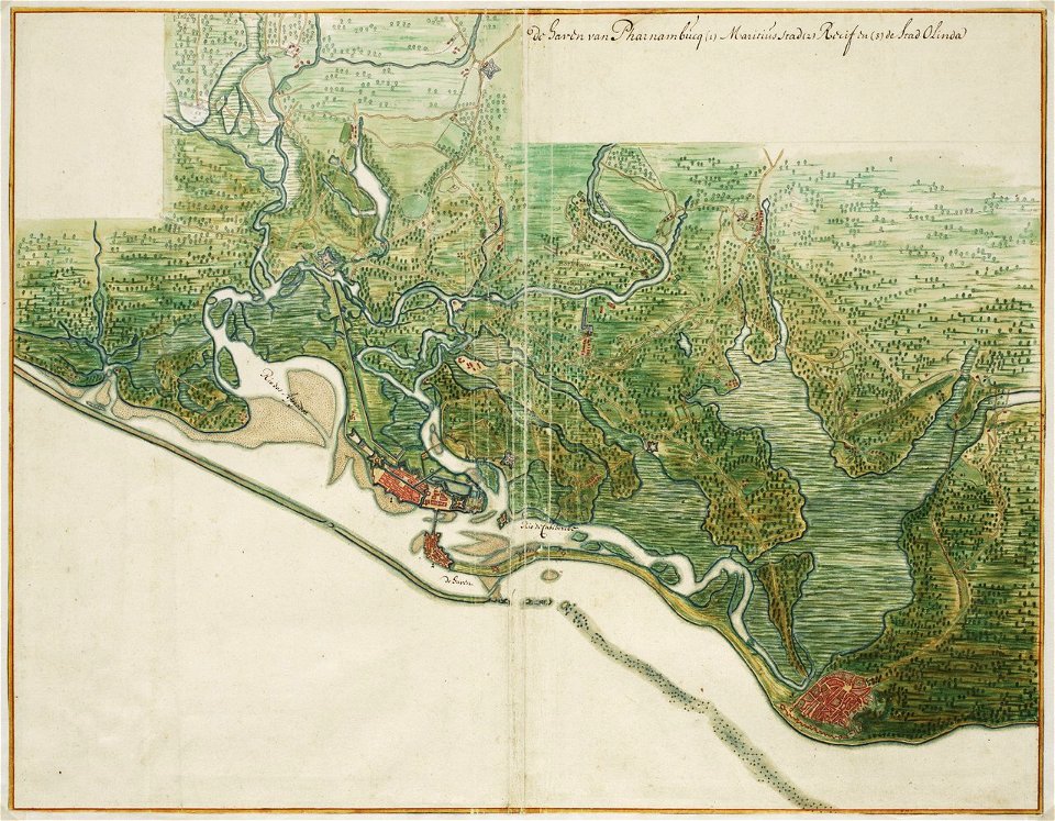
old maps of dutch brazil
johannes vingboons
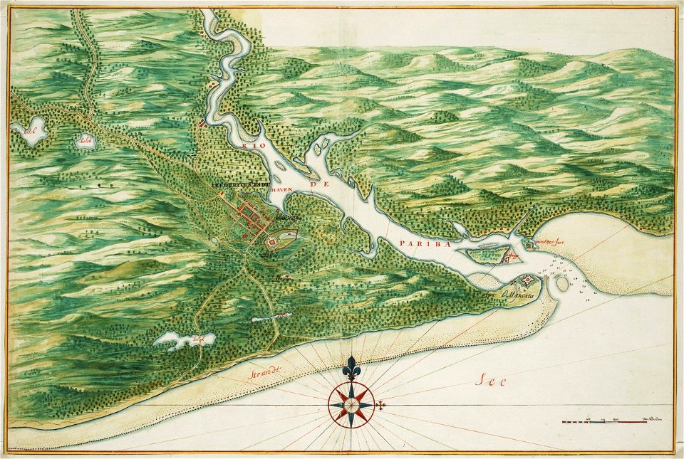
old maps of dutch brazil
johannes vingboons
old maps of dutch brazil
johannes vingboons
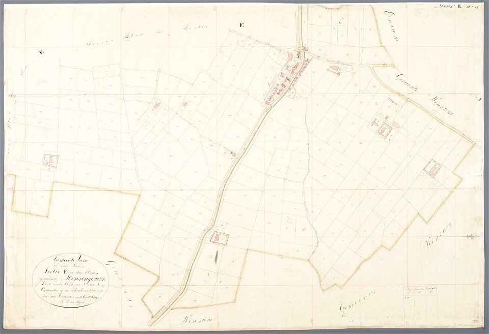
mathenesse (mensingeweer)
maps of de marne
asingaborg (ulrum)
ulrum
maps of berlin-wannsee
park klein-glienicke
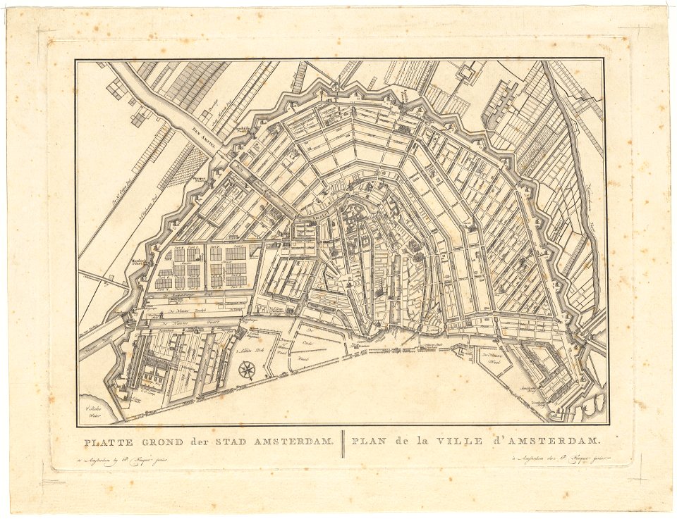
old maps of amsterdam
pierre fouquet junior
old maps of amsterdam
pierre fouquet junior
johann george schreiber
old maps of saxony
description de l'universe
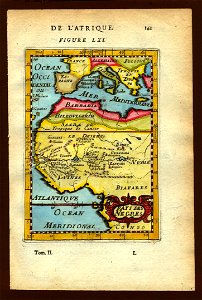
1683 maps of africa
maps with stab-werner projection
petrus apianus
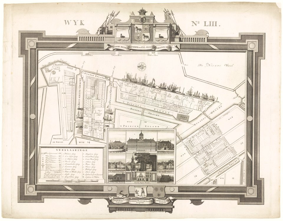
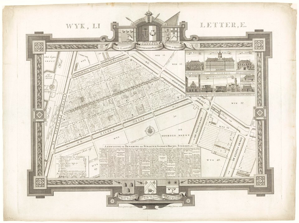
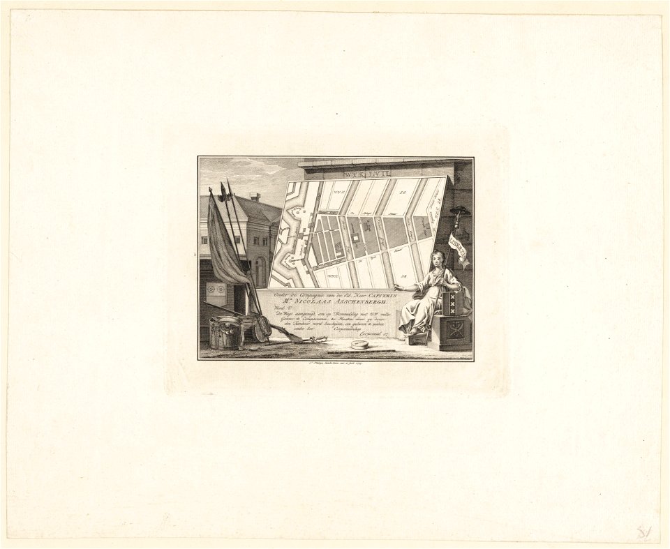
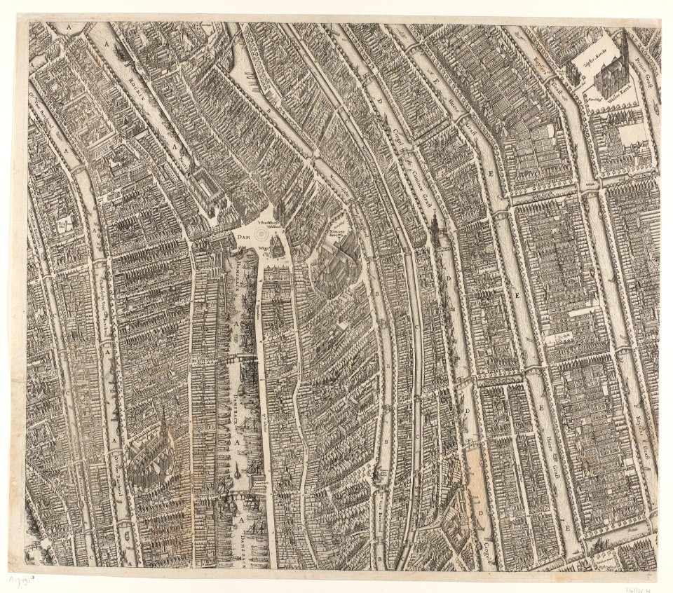
maps in the stadsarchief amsterdam
caspar philips
maps in the stadsarchief amsterdam
caspar philips
maps in the stadsarchief amsterdam
caspar philips
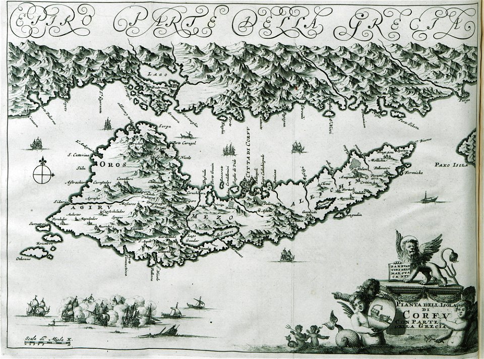
old maps of greece
corfu
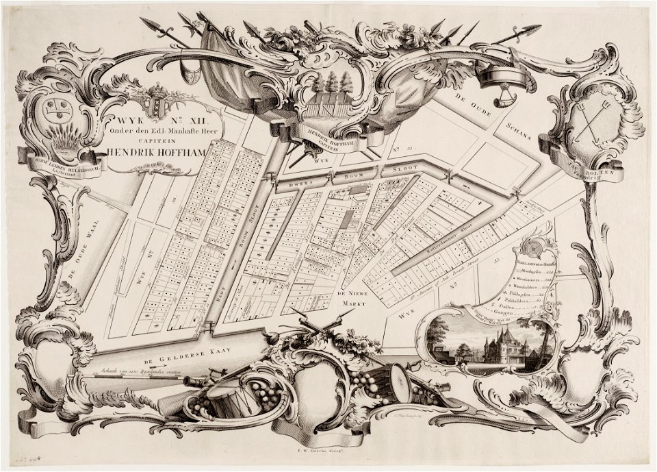
maps in the stadsarchief amsterdam
caspar philips
maps in the stadsarchief amsterdam
caspar philips
maps in the stadsarchief amsterdam
caspar philips
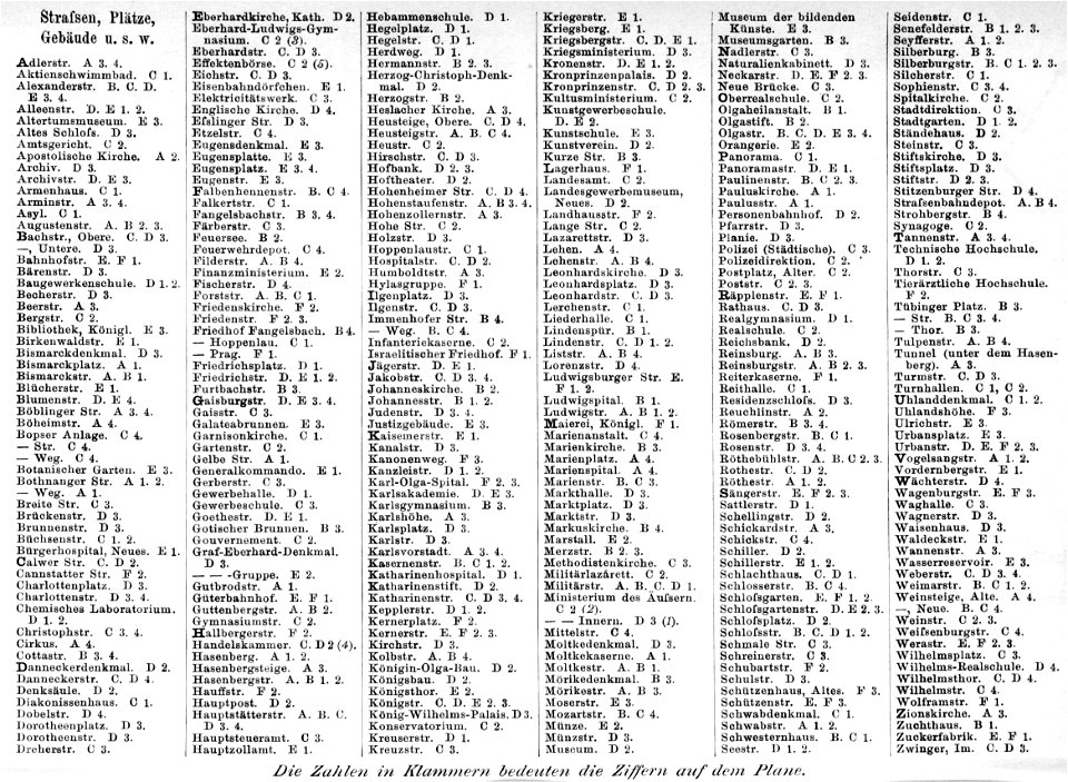
brockhaus' konversations-lexikon (1892)
maps of stuttgart
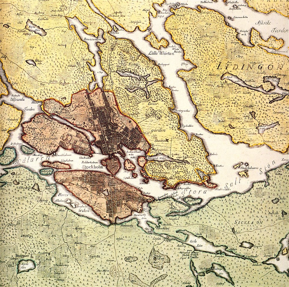
maps of lidingö
breviks gård
old maps of stockholm by georg biurman
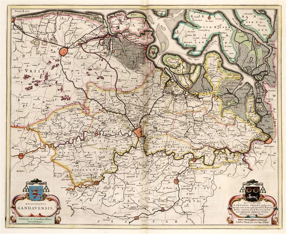
old maps of ghent
atlas van loon
drie aanmerkelyke reizen
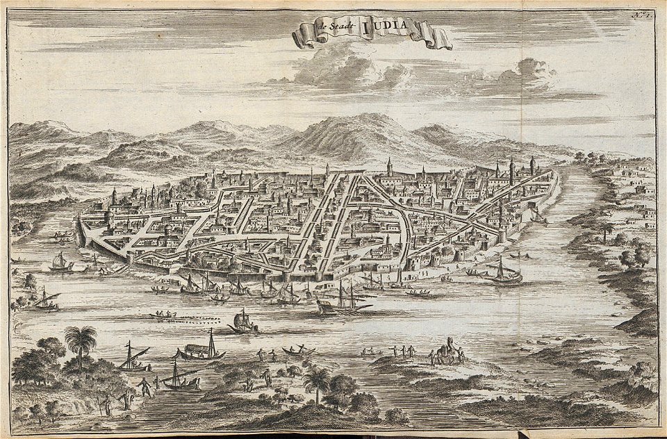
old maps of ayutthaya
historical images of sluck
maps of sluck
historical images of słonim
maps of slonim
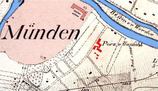
fayence-manufaktur münden
maps of hann. münden
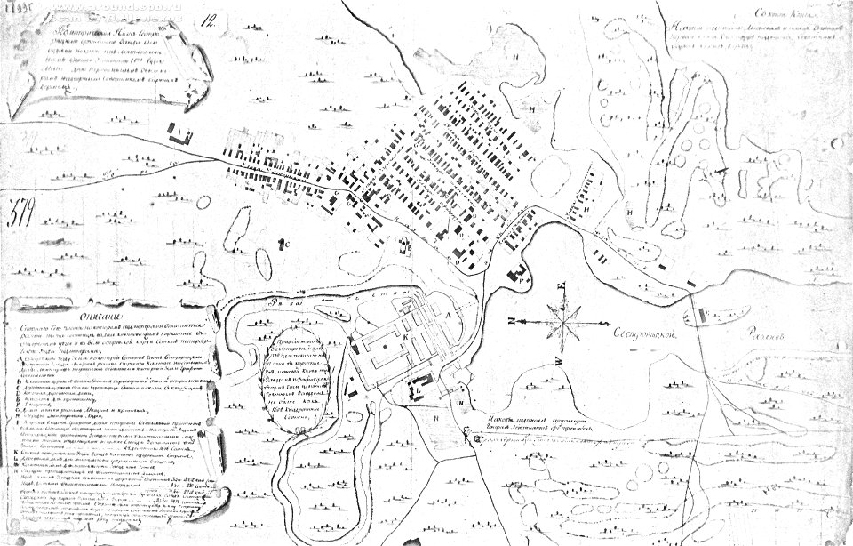
18th-century maps of russia
sestroretsky spill
theatrum urbium (1610)
old maps of cagliari
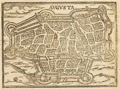
theatrum urbium (1610)
1610s maps of augsburg
historical images of čerykaŭ
maps of čerykaŭ
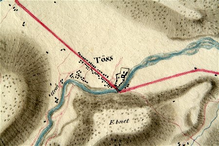
töss (winterthur)
töss abbey
description de l'universe
1719 maps of africa
description de l'universe
1683 maps of africa
description de l'universe
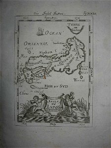
old maps of japan
geographical illustrations by coronelli
maps of lefkada
description de l'universe
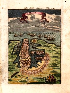
old maps of valletta
map of paris by claes jansz. visscher - derivate files
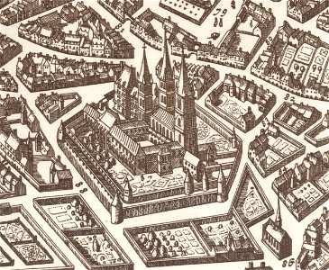
historical images of abbaye de saint-germain-des-prés
history of tbilisi
tbilisi
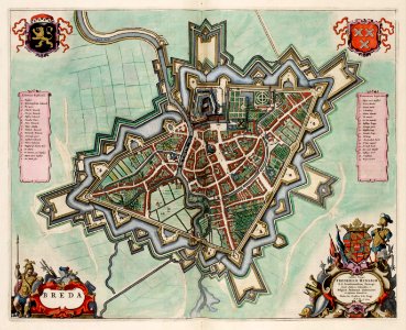
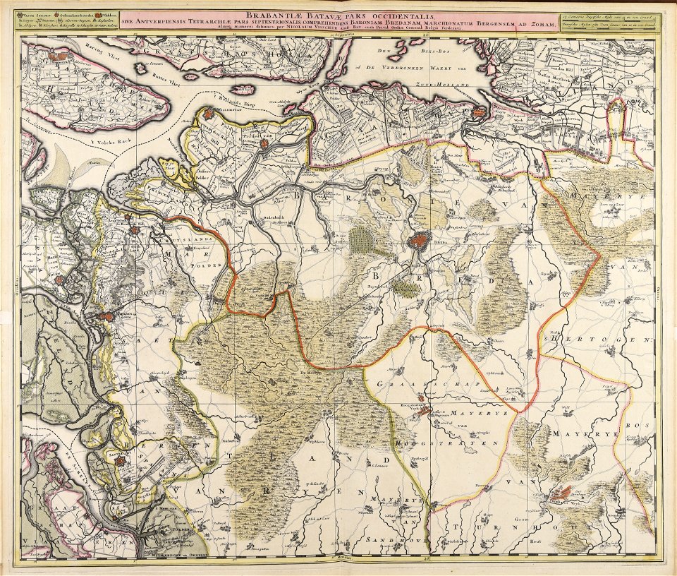
coats of arms of breda
netherlands
portraits of jean racine
history of soissons
coats of arms of cities in lot-et-garonne
bernard germain de lacépède
fonds ancely - bibliothèque municipale de toulouse - maps
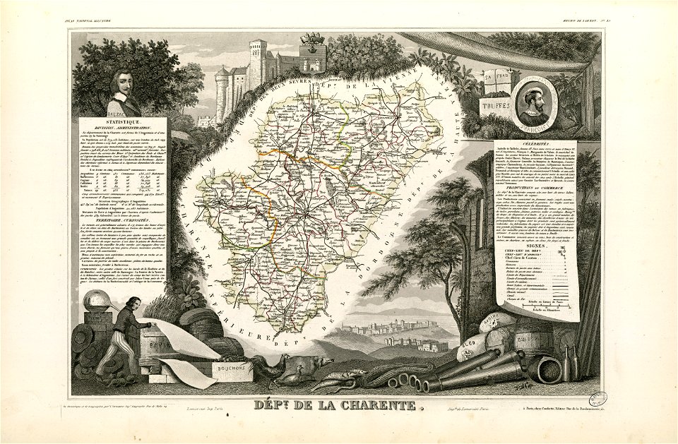
coats of arms of cities in charente
hatched coats of arms
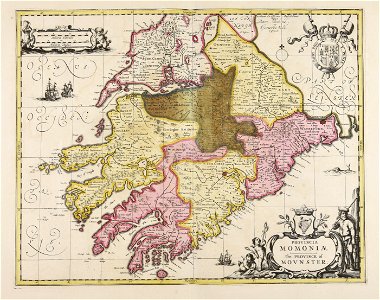
old maps of ireland
old maps of ireland
gerard valck
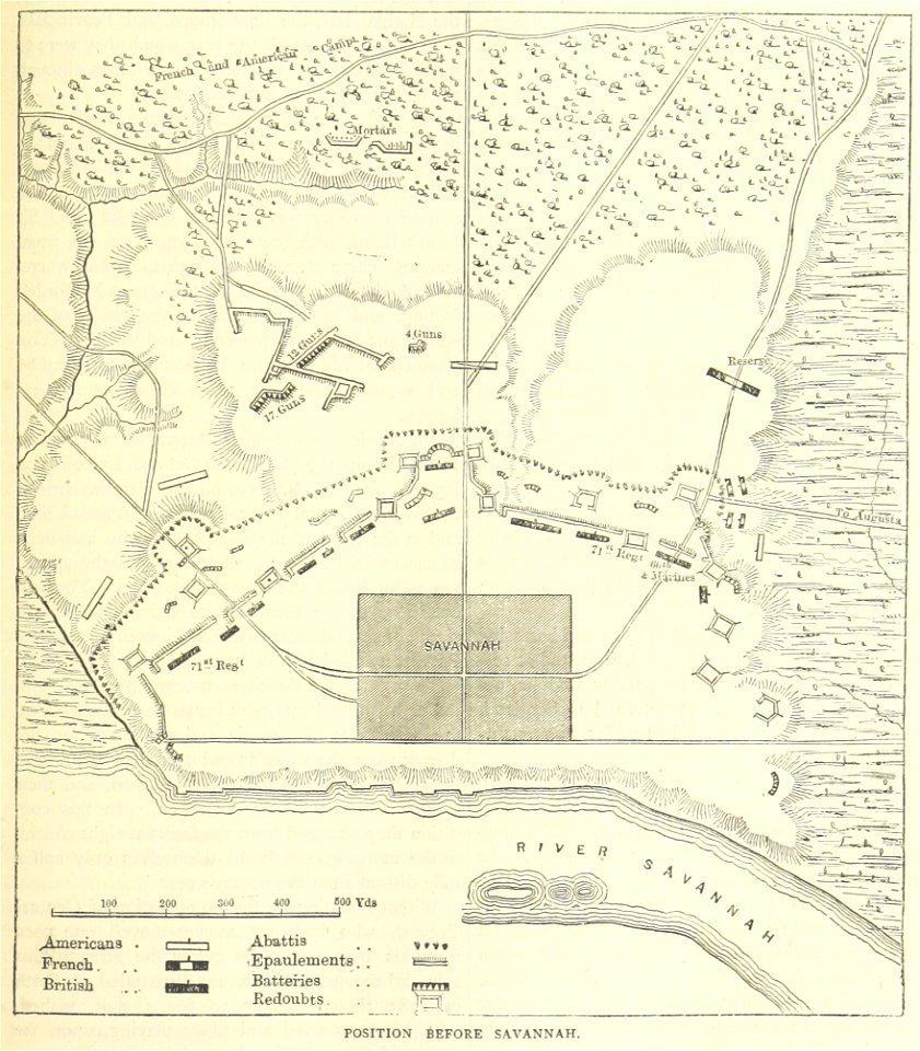
old maps of the american revolution
siege of savannah (1779)
19th-century maps of argentina
1780 in south america
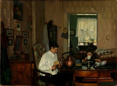
art 3. works from the collection 1814-1950
arkitektur og design
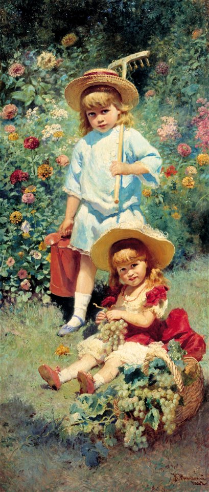
19th-century childhood in painting
paintings of people in nature
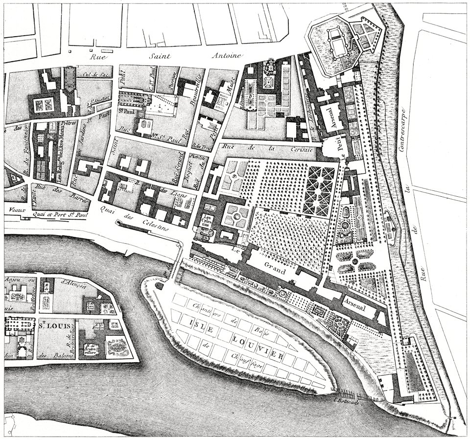
quartier de l'arsenal
bastille
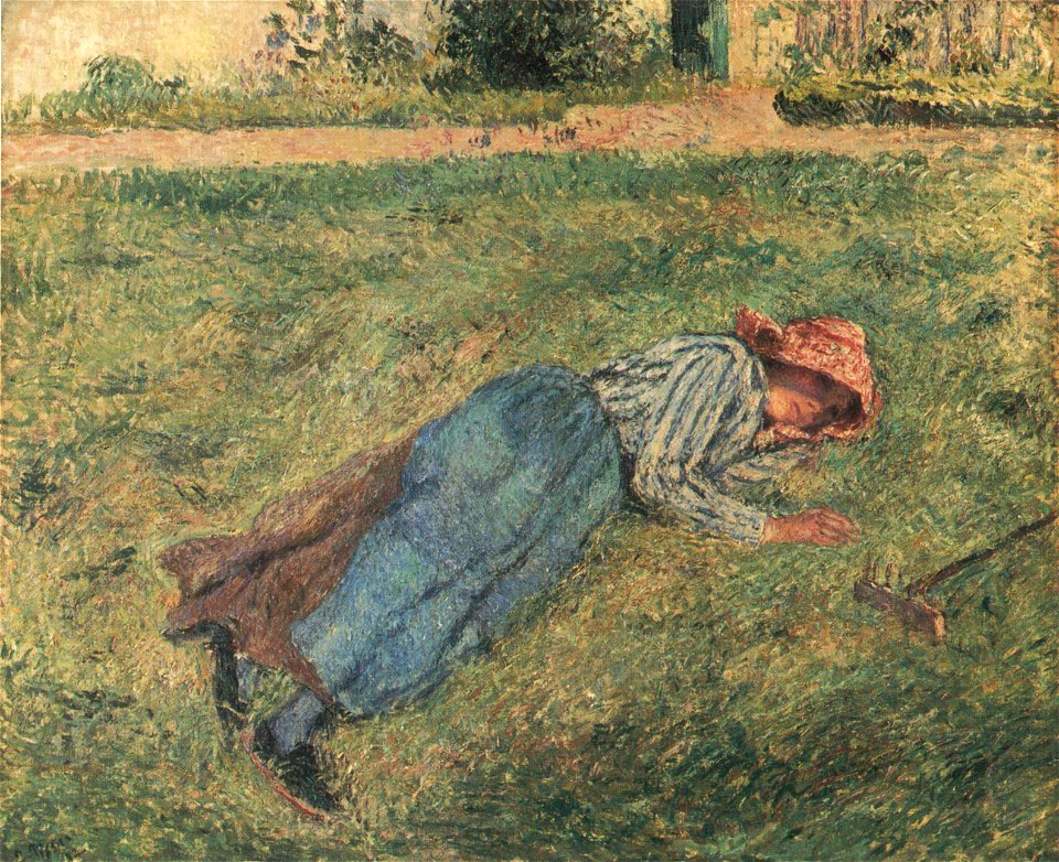
paintings of peasants by camille pissarro
paintings of pontoise by camille pissarro
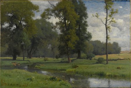
george inness
june
harvard university
clocks in art
beehive panel paintings in the museum of apiculture
radovljica
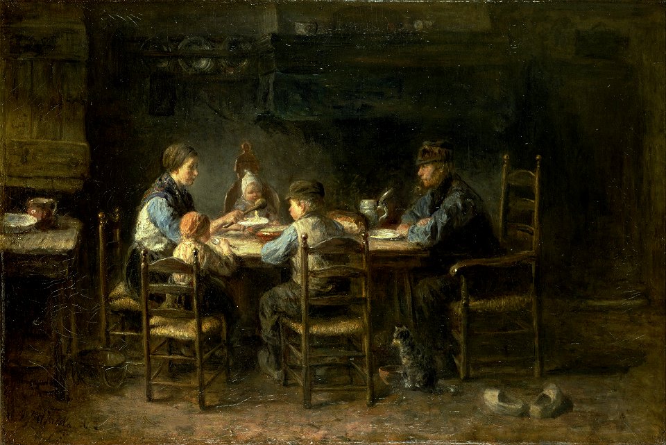
paintings of peasants
paintings of cats
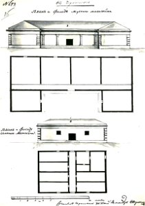
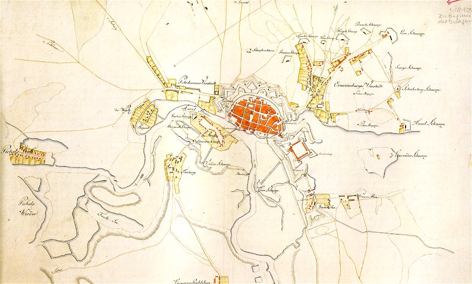
historical documents of the spandau citadel
festung spandau
maps made in the 18th century
johann baptist homann
maps made in the 17th century
nicolaes visscher ii
maps of bremen by c. a. heineken
maps made in the 18th century
maps made in the 17th century
frederick de wit
topographic maps of afghanistan
wakhan corridor
maps made in the 17th century
nicolaes visscher ii
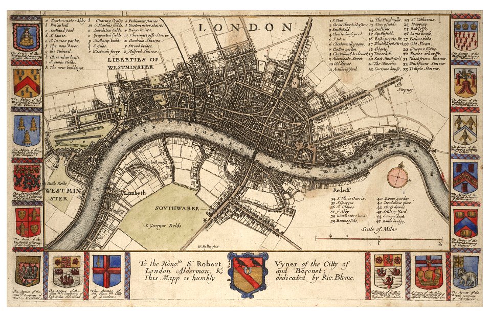
university of toronto wenceslas hollar digital collection
hollar maps and plans of london
maps made in the 18th century
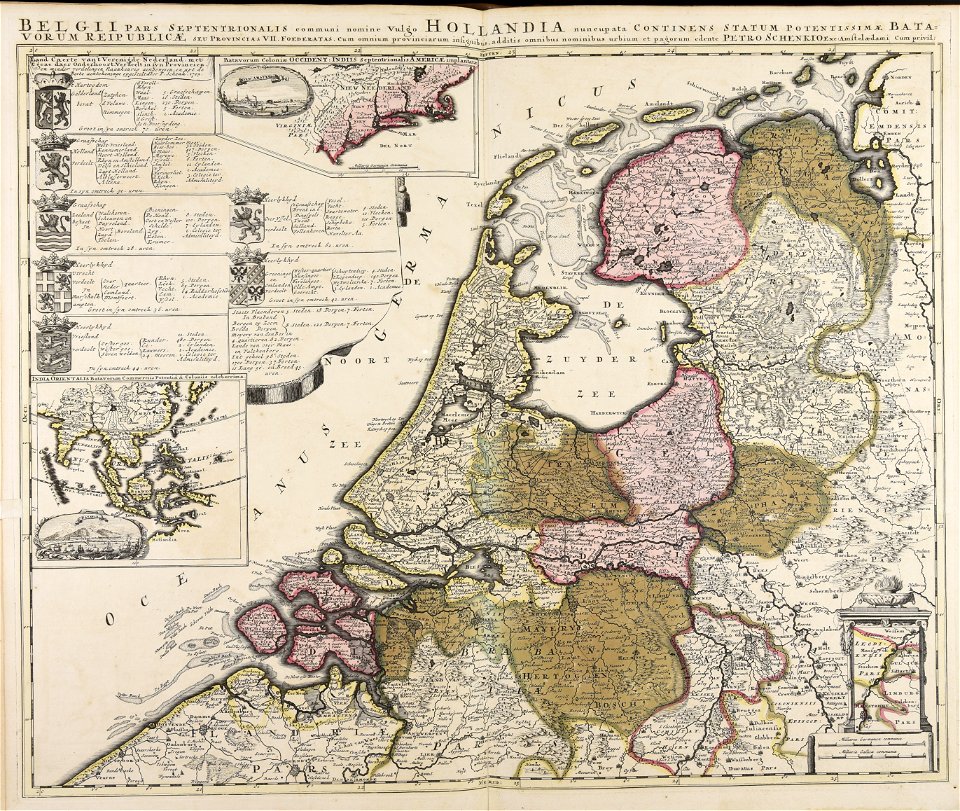
paesi bassi
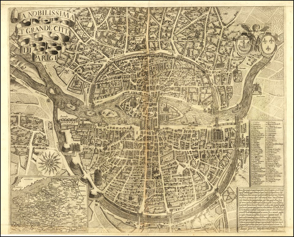
maps of paris from the barry lawrence ruderman antique maps inc.
la nobilissima et grande città di parigi by matteo florimi
bruce county
ontario
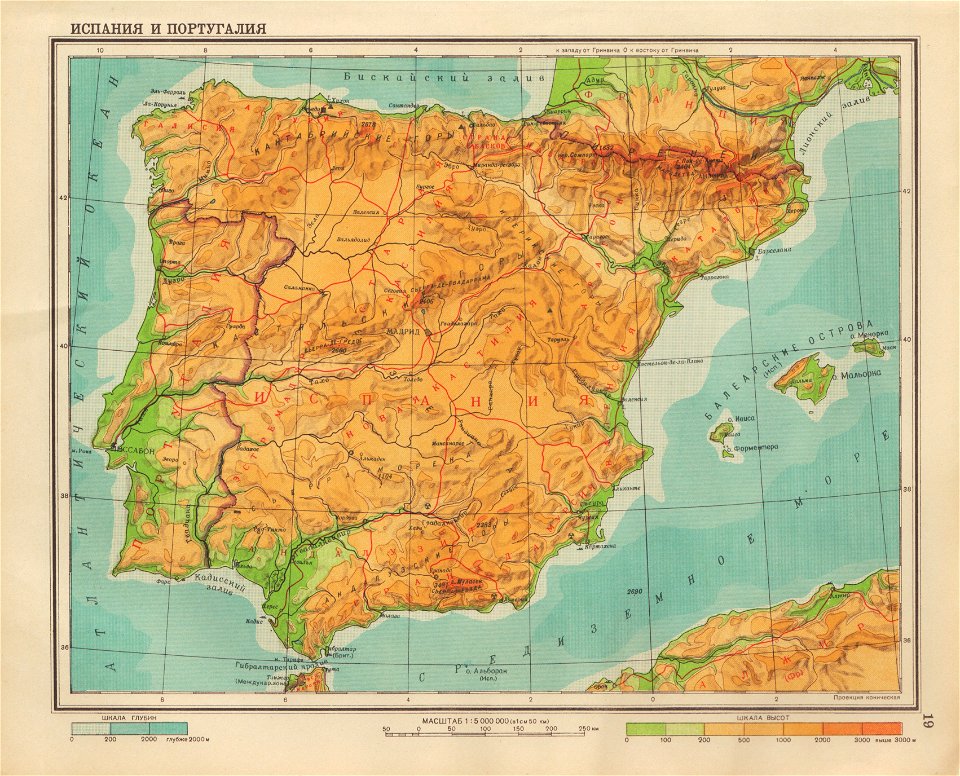
geographical atlas for the 5-6 grades of secondary school (1941)
old maps of the iberian peninsula
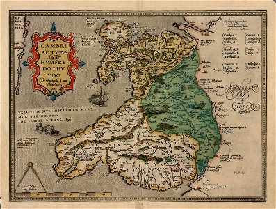
maps in the national library of wales
old maps of whole wales (alone)
johann baptist homann
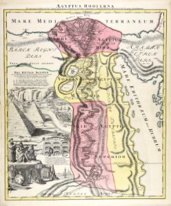
1720s maps of egypt
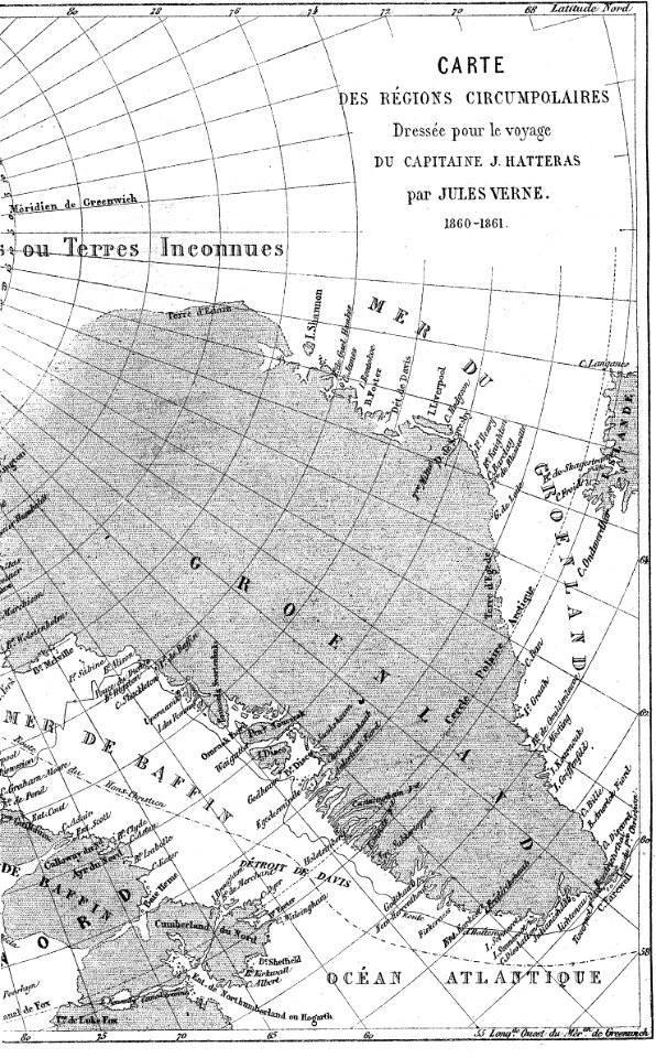
illustrations from the english at the north pole by riou and montaut
old maps of the arctic
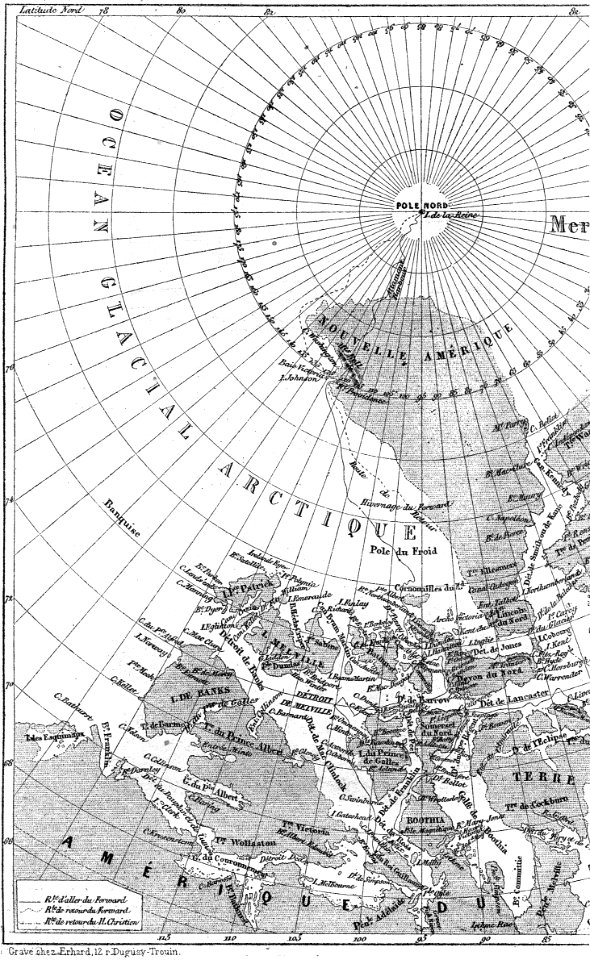
illustrations from the english at the north pole by riou and montaut
old maps of the arctic
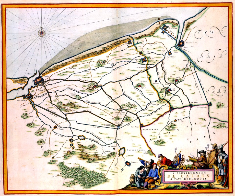
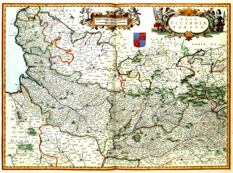
maps with cartouches
atlas van der hagen
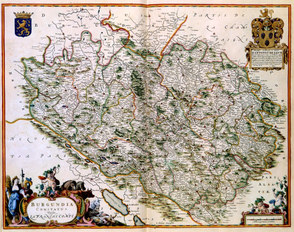
17th-century maps of france
maps with cartouches
17th-century maps of france
maps with cartouches
maps with cartouches
history of picardie
dutch 17th-century prints in the rijksmuseum amsterdam
maps in the rijksmuseum amsterdam
dutch 17th-century prints in the rijksmuseum amsterdam
maps in the rijksmuseum amsterdam
dutch 17th-century prints in the rijksmuseum amsterdam
maps in the rijksmuseum amsterdam
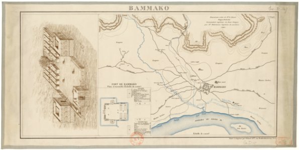
bamako in the 1880s
military maps
maps made in the 17th century
nicolaes visscher ii
maps made in the 17th century
nicolaes visscher ii
history of lorenzkirch
old maps of saxony
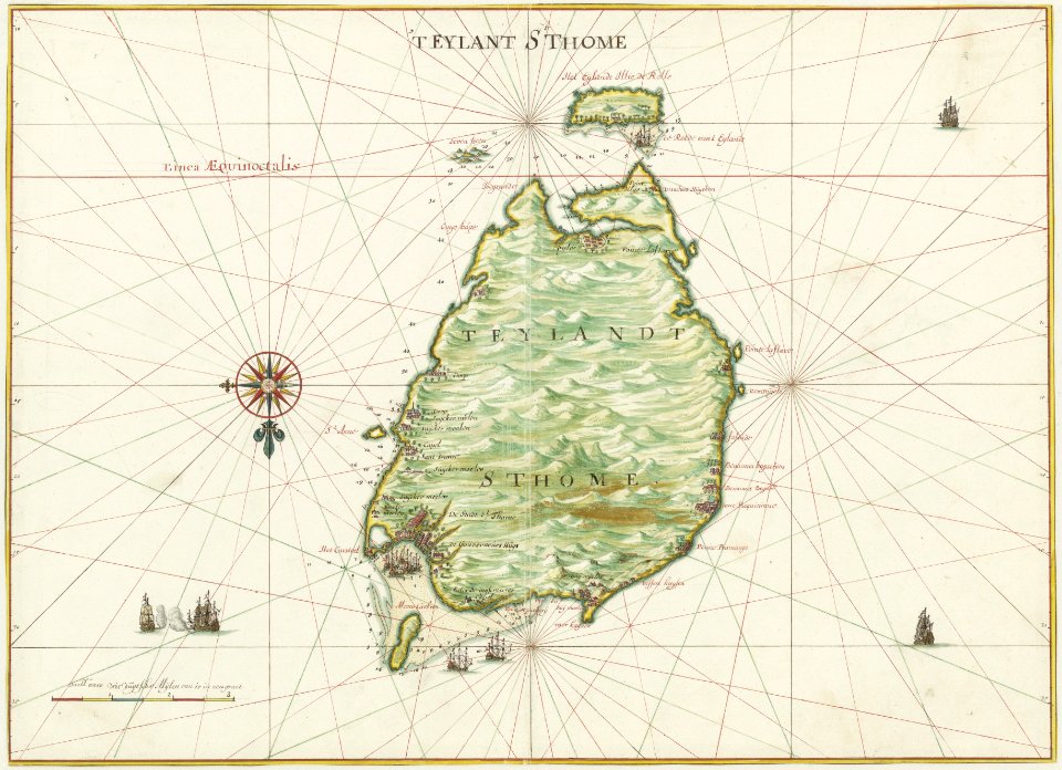
maps of the west-indische compagnie
1665
maps of the dutch east india company - indonesia
onrust island
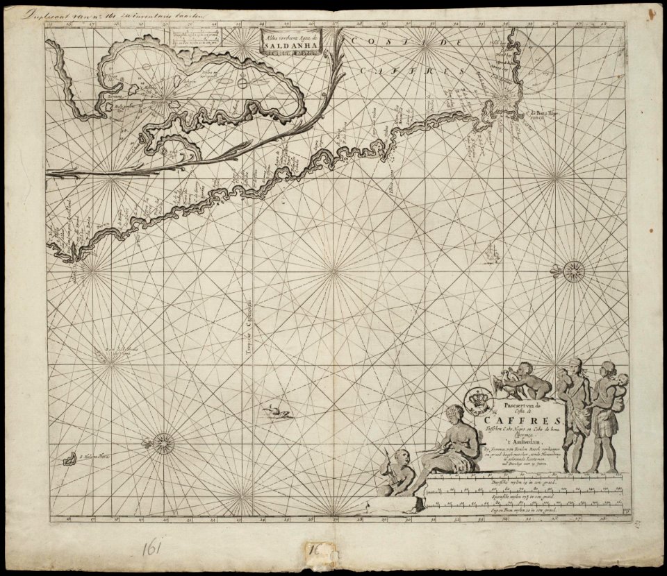
old maps of the dutch east india company - africa
johannes van keulen
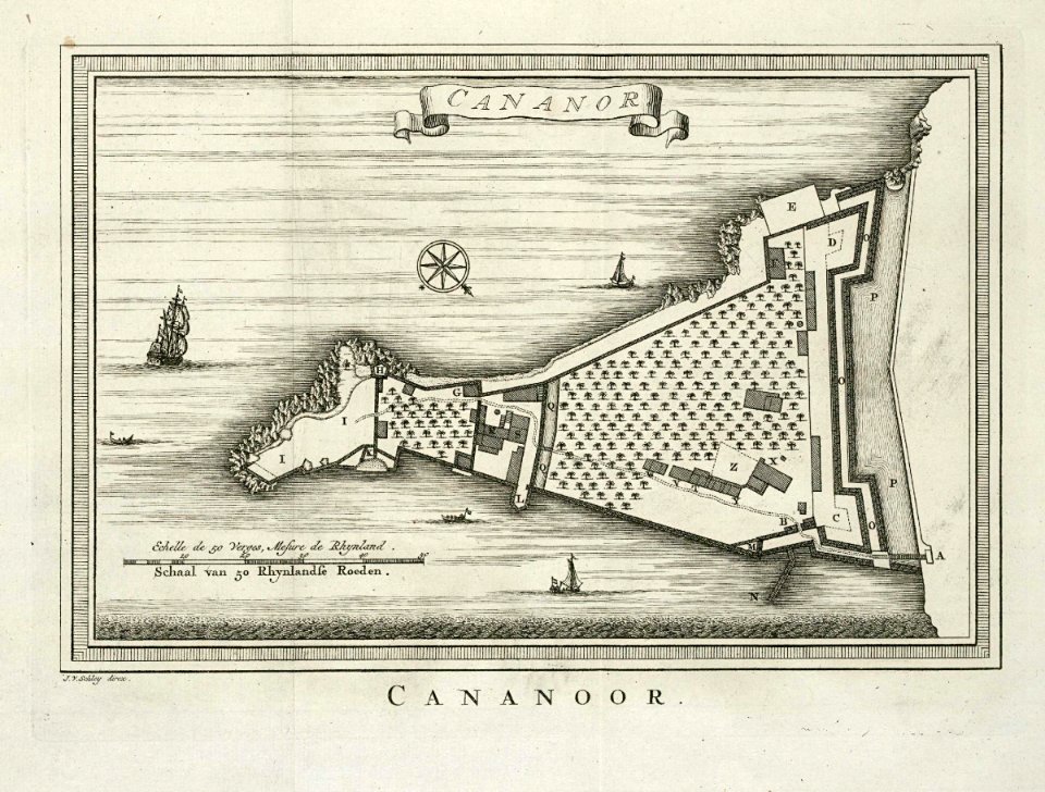
maps of the dutch east india company - india
historical images of st. angelo fort
7701 - 7800 of 40,684
Next page
/ 407